
This article may contain affiliate or compensated links, and may feature complimentary or discounted experiences. All opinions are my own. Please read the Privacy Policy & Disclaimer for more info.
No map has ever been neutral –they have all been drawn by someone with an agenda. The world you think you know –its borders, its names, its center and its edges– was described to you by people with something to prove: cartographers who placed themselves at the middle of everything, colonizers who renamed what they claimed, politicians who drew lines along rivers of faith rather than geography. This is an essay about why maps are misleading, how they shaped our worldview, and what happens when you start noticing the bias.
What the World Map Is Actually Telling You: Maps Are Never Neutral
How Maps Filled the Unknown with Fear: Who Gets to Be at the Center and Who’s Left to the Dragons
Every map ever drawn is an argument, not a record. A biased description of what matters: what belongs at the center and what gets pushed to the edges. Most of us spend our entire lives unknowingly navigating a world that was described to us by people with an agenda.
Let’s start at the beginning. Eratosthenes, the Greek mathematician who calculated the circumference of the Earth with remarkable accuracy around 240 BCE, drew a map that placed Rhodes at its center –because that’s where he was. It wasn’t arrogance so much as assumption: the world radiates outward from where you stand. Every civilization that has ever drawn a map has made the same assumption.
Medieval cartographers placed Jerusalem at the center of their mappae mundi, with paradise up, purgatory down, and the known world displayed around the Holy City. These were cosmological statements, maps of meaning rather than territory. Meanwhile, cartographers of the Islamic world centered their maps on Alexandria or Mecca.
The unknown edges of these maps were filled with what their makers feared might be there: sea monsters, serpents, creatures borrowed from traveler’s tales and fevered imagination. Although very popularized, the phrase Hic Sunt Dracones –here be dragons– appears on only two known historical objects, with the more common inscription being Terra Incognita, unknown land. Beyond this point, the familiar rules don’t apply, and monsters may live.
The mapmakers knew where their knowledge ended. They marked it. What they didn’t know, they filled with fear –which is exactly what we still do. The dragons have moved. They no longer live at the edges of maps. They live in the countries we’ve been told to fear, the cultures we’ve been taught to distrust, the places our news cycle fills with disaster and never revisits during reconstruction. Hic Sunt Dracones is written on today’s maps, in a real but invisible way.


Why North Is on Top: How Map Projections Distort Reality and the Politics of Perspective
We rarely question why north is at the top of our maps. It feels self-evident –almost gravitational, as if the planet itself ordains it. But it doesn’t. North-up became the dominant convention during the age of European maritime expansion, when the civilizations doing the most mapmaking happened to be in the northern hemisphere and saw no reason to place themselves anywhere other than above.
The 12th-century Arab geographer Al-Idrisi, working for the Norman King Roger II of Sicily, drew his map with south at the top –because that was the convention in his tradition, and because the most important places in his world were in the south. Turned upside down, it looks startlingly familiar. Turned the right way up, it looks like everything you thought you knew has been inverted. Which is precisely the point: up and down on a map are not geography. They are politics. And we’ve been living inside one political choice for so long that it feels like nature.
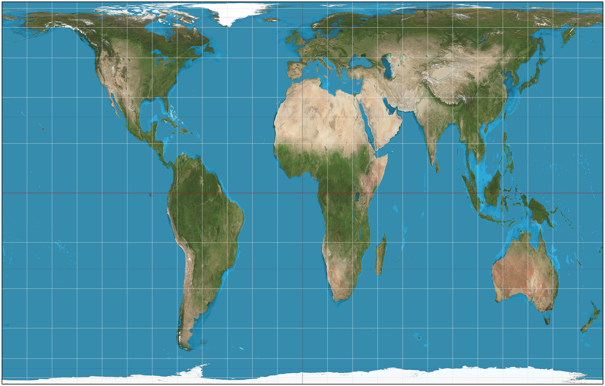
Gerardus Mercator’s 1569 projection, designed for naval navigation, became the de facto image of the world for centuries –hung in classrooms, embedded in every mental model of what the planet looks like. Its flaw is that it inflates landmasses the further they are from the equator. Greenland appears roughly the size of Africa on a Mercator map, even if it actually is fourteen times smaller. Europe looks like a substantial presence at the center of things. In reality, the African continent is large enough to contain the United States, China, India, and most of Europe simultaneously.
The Mercator projection wasn’t a conspiracy –but its effects served power neatly. The colonizing nations of northern Europe appear large and significant. The colonized territories of the tropics appear small, peripheral and subordinate. A worldwide study of over 130,000 people found that regular exposure to the Mercator projection measurably distorts people’s understanding of actual country sizes –the map has rewired how we think about relative importance across generations.
Google Maps uses a modified Mercator projection. The little blue dot that places you at the center of the screen is, in its way, the most honest map ever made: it shows exactly what every map has always shown, which is the world experienced from a single, specific, unrepeatable vantage point. You, as the navel of the universe, just as Eratosthenes placed Rhodes and medieval cartographers placed Jerusalem and Mecca. The technology has changed, but the assumption hasn’t.
The Peters projection, developed in 1974, attempted a correction –sacrificing shape accuracy to represent landmasses at their true relative sizes. It made Africa enormous, as it actually is. It shrank Europe and North America to their real proportions. It was controversial in ways that tell you everything: the people who objected most strongly to an accurate map were the ones who’d benefited most from an inaccurate one.


From Drawing to Building: When the Map Becomes a Blueprint
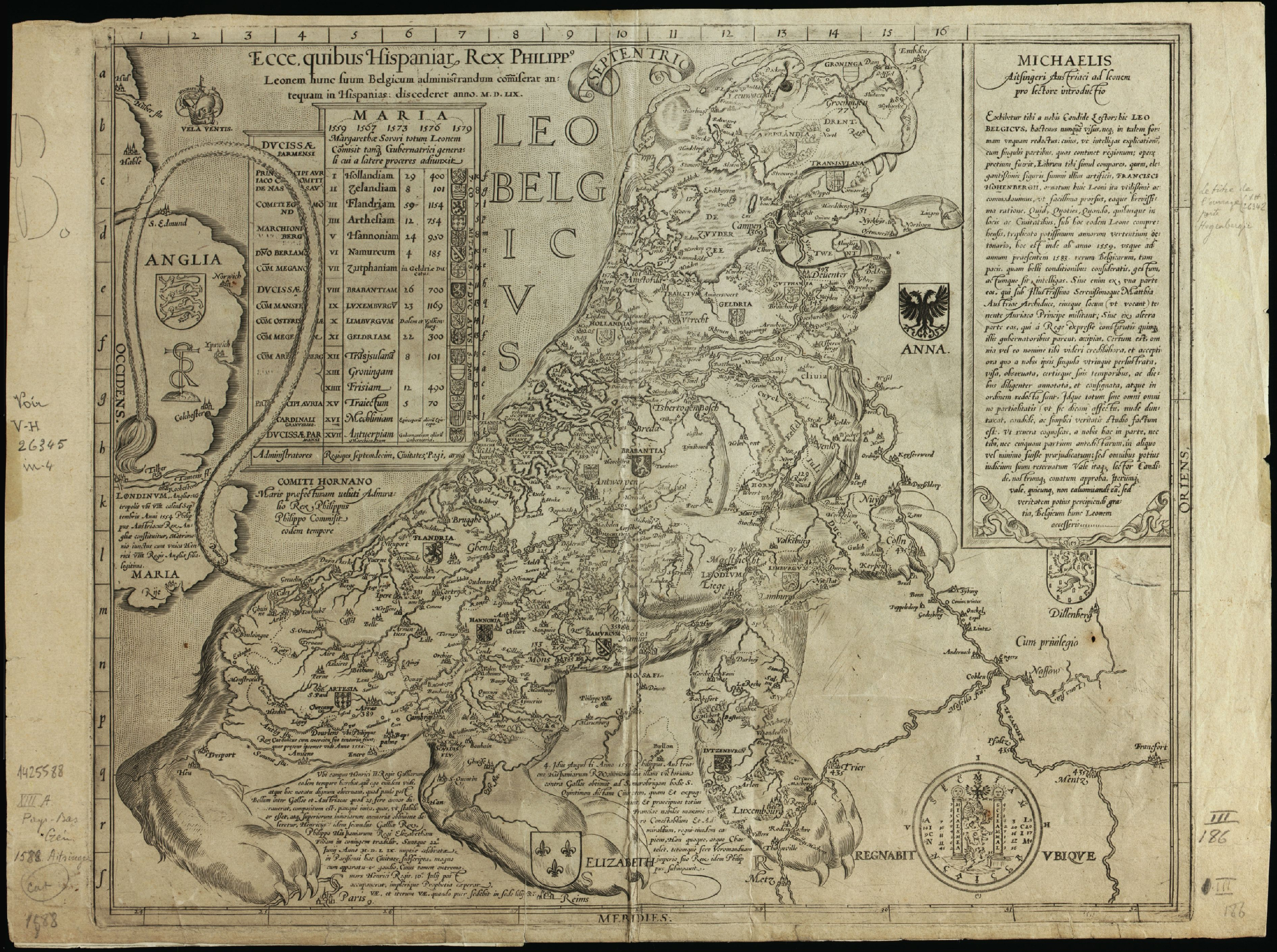
Sometimes the agenda isn’t hidden at all, it’s drawn right into the shape. In 1583, Michaël Eytzinger mapped the Low Countries not as they were, but as he wanted them to be seen: in the form of a roaring lion –the city of Groningen on its nose, Luxembourg in its front paw, the coast along its back. The Leo Belgicus, as it became known, was cartography as political statement: it was more important to portray strength than to be accurate. Other mapmakers borrowed the trick: Russia depicted as a menacing octopus, Türkiye as a turkey, France as an eagle, China as a pig. The animal wasn’t chosen to describe the territory, but to make an argument about it. Which is, of course, what every map has always done.
Other acts of cartographic invention were more subtle and a lot more consequential. Greenland didn’t need to be drawn in a specific shape to make an argument. It just needed a name that was able to sell rather than describe. Erik the Red christened it deliberately because “people would be attracted to go there if it had a favorable name”. The island was –and remains– mostly covered in ice. Historians have recently complicated the “deliberate deception” idea, noting that during the Medieval Warm Period the southwestern fjords genuinely supported vegetation and livestock –so the name was perhaps more exaggeration than outright lie. But that nuance makes it more interesting, not less: even our story about the first great act of geographical marketing has been simplified into a cleaner myth than the evidence supports.
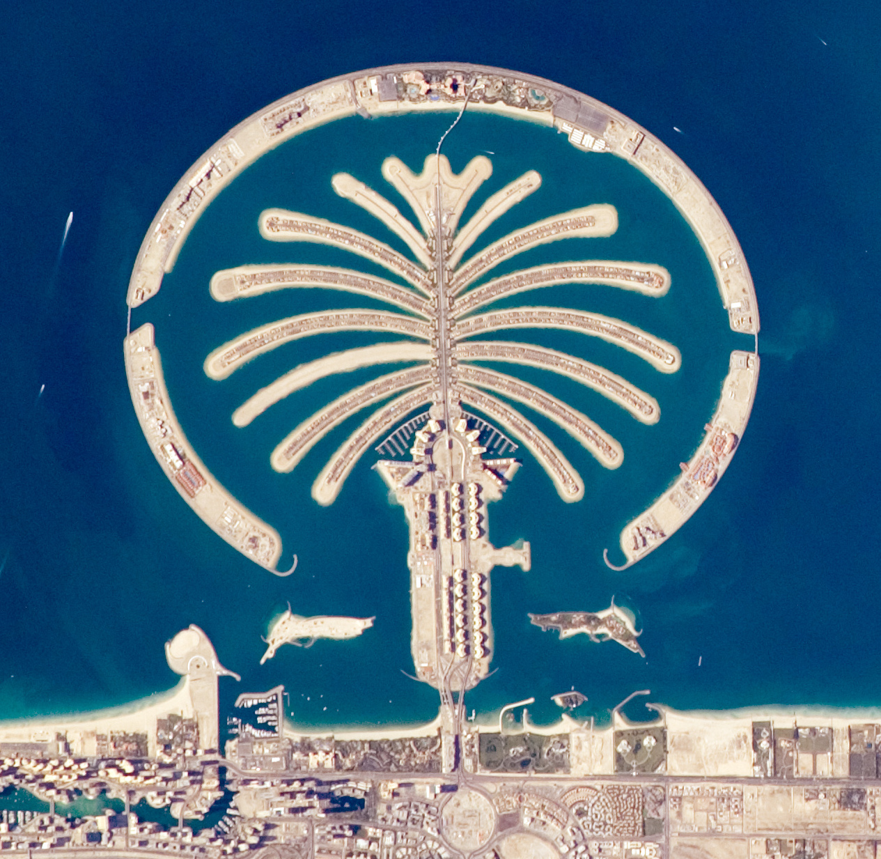
Greenland was marketed with words. Dubai took it to the next level. Palm Island isn’t a name chosen to attract settlers or a projection designed to flatter a power –it’s the territory itself, dredged from the sea and shaped into something visible from above. The territory was remade to match a map of human ambition. The logical endpoint of cartographic thinking: if the map is the argument, let’s build the argument into the land itself.
Whose God Drew the Border? How Religion Redrew the Map
Maps draw lines on land while religion draws lines between people: who belongs on which side of the line and who we are in relation to it.
The borders that seem most fixed, most unnatural, least obviously geographical are often the ones drawn along lines of faith rather than topography.
The partition of India and Pakistan in 1947, one of the largest forced migrations in human history –somewhere between ten and twenty million people displaced in months– followed a line drawn by a British lawyer named Cyril Radcliffe who had never visited the subcontinent and completed his work in five weeks. The border he drew was religious: Muslim-majority areas to Pakistan, Hindu and Sikh-majority areas to India. Rivers, farmlands, families, cities –all bisected by a theological argument about who belonged where.
Ireland is another example of the same cartography model. The partition of 1921 drew a border across the island along lines of faith: Catholic majority to the south, Protestant majority to the north, creating a division that defined a century of conflict, displacement and identity politics. The border didn’t follow rivers or mountains, but church attendance. Families on the same street found themselves in different countries because of which God they prayed to and in which language the service was conducted.
Cyprus remains divided today along a line that cuts through the capital city of Nicosia –Greek Orthodox Christians to the south, Muslim Turks to the north, a UN buffer zone between them that has existed since 1974. You can stand at the crossing point and look at a city that has been severed by faith. The street signs change language mid-block. The minarets and the church domes face each other across a strip of abandoned buildings.
But nowhere is this more viscerally present than in the former Yugoslavia. Bosnia and Herzegovina, Croatia and Serbia occupy the same small piece of land, speak mutually intelligible languages and share centuries of intertwined history. What separates them, politically and psychologically, is almost entirely religious: Bosniaks are Muslim, Croats are Catholic, Serbs are Orthodox. The wars of the 1990s were described as ethnic conflicts, but ethnicity there is largely a proxy for confession. The nationalism that tore the region apart was, at its root, theological cartography –a map drawn in church and mosque attendance, in whose saints you prayed to and whose script you wrote in. I have crossed those borders dozens of times and, honestly, the landscape doesn’t change, but the vibe changes.
Northern Africa offers a different version of the same distortion. Egypt, Libya, Tunisia, Morocco, Algeria, Mauritania –countries that are geographically, unambiguously African– are routinely categorized in Western imagination as part of the Middle East. The reason isn’t misconception of geography but the lens of religion. Muslim-majority nations in North Africa get slotted into a vaguely defined Islamic geography, separated from sub-Saharan Africa below them and from Europe across the Mediterranean. The continent gets bisected by faith. A Moroccan is African –but in the Western mental map, she might as well be from Riyadh.
Lebanon’s entire political system is built on a formal distribution of power along religious lines –the President must be a Maronite Christian, the Prime Minister a Sunni Muslim, the Speaker of Parliament a Shia Muslim. This arrangement, called confessionalism, was designed in 1943 to reflect the demographic balance of a census that is now almost a century old and has never been officially updated. The country is literally governed by a map of religious belonging.
But the most complicated map is the one we can’t agree upon at all. Israeli maps and Palestinian maps show different things in the same geography –different names, different borders, different existence. The maps don’t describe a disputed territory, but make an argument about whether a people exist. Which brings us to talk about the elephant in every room: colonialism.
The Power to Name Is the Power to Own: How Colonialism Renamed the World
The Places That Got Their Names Stolen
There is a claim you probably have encountered, usually delivered with the confidence of someone who believes they’ve found an ace up their sleeve: there is no such thing as Palestine, because there is no letter P in Arabic. Let that sit for a moment.
The argument goes: if Arabic has no P sound, the name “Palestine” must be a foreign imposition, therefore the place itself is illegitimate.
Leaving aside that this logic would also erase Pakistan for the same reason –a name coined by Muslim scholars in 1933, which Arabic speakers render as ‘Bakistan’– the claim is historically illiterate. The name Filistin appears in Ancient Egyptian records from the twelfth century BCE and in Assyrian inscriptions centuries before Arabic even existed as a written language. Palestinians call themselves Filastiniyyun, from Filistin. The “no P” argument isn’t linguistics, it’s politics wearing a grammar costume –an attempt to use language to erase a people by questioning their very name. It’s one of the most explicit illustrations of an indisputable principle: the power to name is the power to define reality. And the power to define reality is, ultimately, the power to decide who exists.
Colonialism understood this perfectly. The renaming of the world was not incidental to the colonial project, it was central to it.
Uluru –the vast sandstone formation sacred to the Anangu People of central Australia, who have lived with and around it for at least thirty thousand years– was renamed Ayers Rock in 1873 by a colonial surveyor honoring a South Australian politician. The Anangu were not consulted. Their relationship to the rock and their entire cosmological framework built around it was deemed irrelevant. The rock was catalogued and renamed, like a specimen. Australia officially restored the name Uluru in 1993, though Ayers Rock lingered in common usage for decades afterward.
The same logic operated across the Americas. Denali, “the tall one”, in the Athabascan language of the Indigenous People who have lived around it for millennia– was renamed Mount McKinley in 1917, honoring a president who had never visited Alaska and had no connection to the mountain. It was renamed Denali again in 2015, prompting congressional objections from Ohio politicians who considered McKinley’s name a point of regional pride. A mountain in Alaska, bearing a name from a language that existed there much before English arrived, became a political football in a state where McKinley had never set foot.
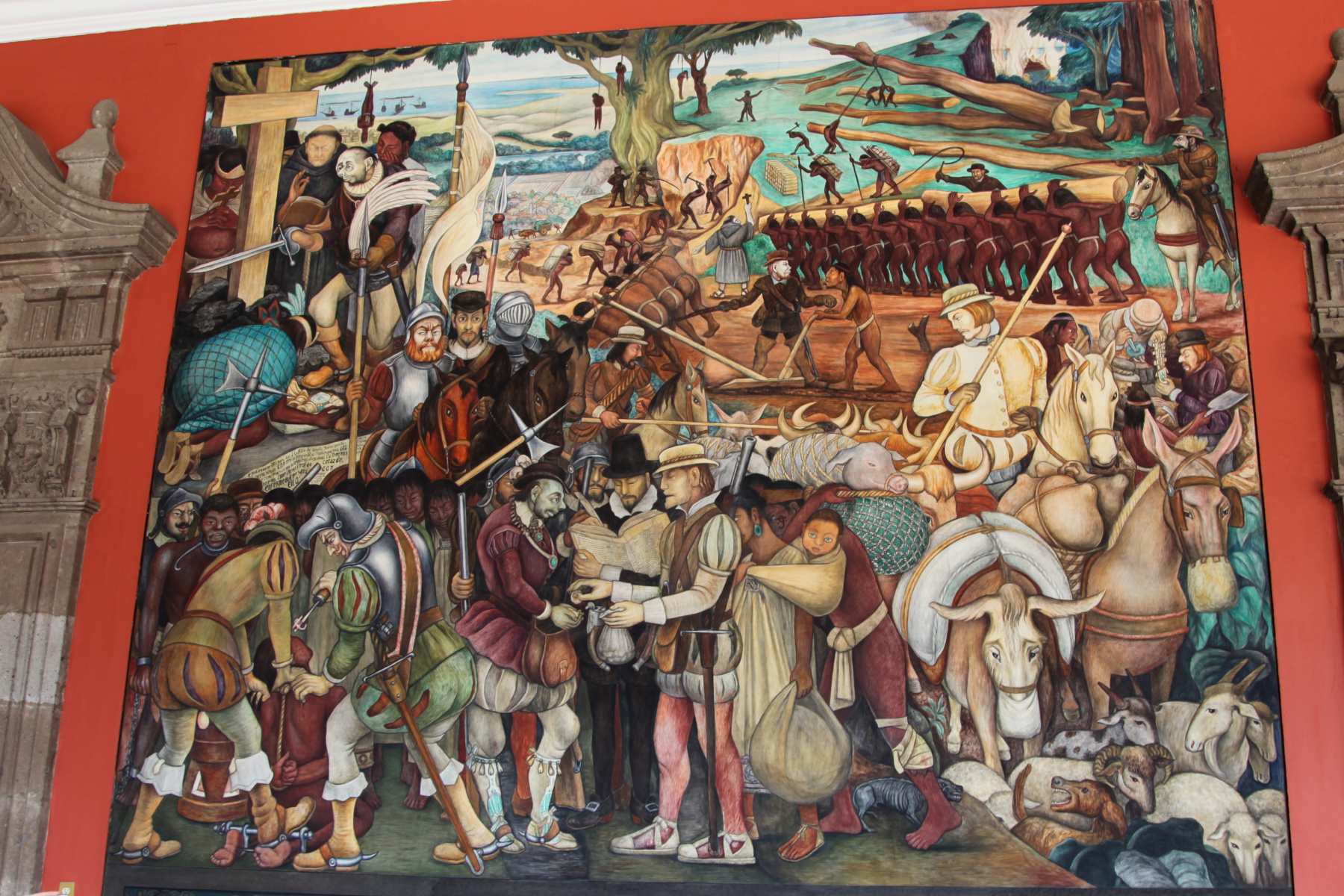
Across South America, Indigenous place names were systematically replaced with Spanish ones, part of a broader project of linguistic and cultural overwriting. The process was so thorough that sometimes the place itself was buried under the new name. Tenochtitlan –the Aztec capital, one of the largest cities in the world at its peak, built on an island in a lake with canals and floating gardens– was razed by Spanish conquistadors in 1521 and rebuilt as Mexico City. The names of the Aztec architects who helped design the new city were lost to history. The lake was drained. The city that replaced it inherited the grid but not the memory.
India’s postcolonial renaming offers the clearest example of a country taking itself back. Bombay– from the Portuguese Bom Bahia, “good bay”, imposed by colonizers who arrived in the sixteenth century– was restored to Mumbai in 1995, the name the Marathi-speaking population had always used. Calcutta, an anglicized corruption of the Bengali Kalikata, became Kolkata in 2001. These acts of repatriation weren’t administrative tidying, but a people reclaiming the right to call their own city by its own name.
Rhodesia became Zimbabwe. The Belgian Congo became Zaire, then the Democratic Republic of Congo. Staging posts and forts named after colonial administrators were renamed after local heroes. Not every name was reclaimed, some became hybrid, negotiated, or later embraced.
Yet the borders drawn at the 1884 Berlin Conference remain one of colonialism’s most durable injuries, cutting straight through ethnic territories and cultural geographies with the clean indifference of a ruler on paper, but the maps were somewhat redrawn: at least some names on those borders changed.
Belgian Chocolate, Italian Coffee and Other Lies We’re Told at the Supermarket
Names were only the beginning. Ownership extended beyond the land into what the land produced. Belgian chocolate, Italian coffee, English breakfast tea. Three things you probably consume. Three origin stories that have been quietly relocated –from the civilizations that developed them to the colonial powers that moved them, scaled them, and put their own names on the label.
You probably know that cacao comes from Africa. What you may not know is that it doesn’t –not originally. Cacao is native to Mesoamerica, cultivated by the Olmec, Maya and Aztec civilizations for thousands of years before Europeans arrived. After colonization decimated the Indigenous populations of the Americas through disease and violence, the Spanish and Portuguese transplanted cacao to West Africa, where colonial labor structures –or more directly put, enslavement– made production profitable. The crop moved and the credit moved with it. Today, Cotê d’Ivoire and Ghana produce the majority of the world’s cacao, and Belgium gets the reputation. The story of chocolate is a story of colonial logistics with the origin erased.
Coffee is Ethiopian. The word comes from Kaffa, the southwestern Ethiopian region where coffea arabica grows wild and has been consumed for over a thousand years. It moved through Yemen, then through Ottoman trade routes into European coffeehouses, where it became a symbol of the Enlightenment. The plant is African, yet the sophistication story is European. The appropriation happened quietly, through the simple mechanism of enough distance between the origin and the consumer.
Tea is Chinese. It has been cultivated, refined and ceremonially consumed in China for millennia before a European ever tasted it. The British East India Company, finding itself uncomfortably dependent on Chinese supply and hemorrhaging silver to pay for it, dispatched a Scottish botanist named Robert Fortune to China in the 1840s with a specific mission: steal the plant, the seeds and the knowledge. Fortune smuggled thousands of tea plants and seeds out of China and established plantations in Darjeeling and Assam using Chinese workers brought to train the local labor force. Within decades, India had overtaken China as the world’s leading tea producer. You drink English Breakfast, or Darjeeling, or Ceylon. Although the drink is still Chinese, the British Empire moved the plant, replaced the origin label, and kept the profit.
What connects the renaming of a mountain and the rerouting of cacao is a single underlying assumption: that the people who originated these things –who cultivated them, named them, and even built civilizations around them– are footnotes to the story, not its authors. It’s the assumption that still treats Indigenous cosmology as charming mythology rather than as what it actually is: tens of thousands of years of accumulated knowledge. We moved the chocolate. We renamed the rock. In both cases, we decided the original owners had nothing left to teach us. We were obviously wrong, but our maps and labels still tell a colonial story –whether we read them that way or not.


East of What? How the Words We Use Shape What We Think
George Orwell understood that if you control the language, you control the thought. Newspeak, the fictional language of his novel 1984, worked by elimination –remove a word, remove the concept it carried, make certain thoughts literally unthinkable. You don’t need a dystopia for this to operate. It happens in the words we use every day, so habitually that we’ve stopped noticing they were a choice.
How Empires Named the World: Geography as a Political Invention
The Middle East. East of what, exactly? East of London, as it happens –the term was coined by British naval strategist Alfred Thayer Mahan in 1902, when Britain was the center of the world, or at least believed itself to be, in contrast to China being seen as the Far East. The region’s own inhabitants have largely absorbed the term –in Arabic it’s al-sharq al-awsat, a direct translation– but people there navigate by older, more specific names: the Mashriq, the Khaleej, Al-Sham, the Levant. ‘The Middle East’ flattens all of that into a single label defined by its distance from somewhere else. It’s a view from a particular window in a particular empire, and we’ve all inherited it as if it were geography rather than perspective.
The broader intellectual framework for this was laid out by Edward Said in his 1978 book Orientalism –still one of the most important reads about how language constructs geography. Said argued that “the Orient” was never a place so much as a European invention: a constructed otherness, defined by everything the West imagined itself not to be: irrational, exotic, sensual, in need of governance. The Orient described a relationship of power, not a region. The map was always political, Said simply made the politics visible.
Eastern Europe is a Cold War invention. The division of the continent into East and West mapped, roughly, onto the Iron Curtain: Soviet-aligned nations to the east, Western democracies to the west. The Berlin Wall came down in 1989, but the mental map has proved considerably more durable. Poland –geographically central to the European landmass and historically a major European civilization– insists, with justifiable irritation, on being called Central Europe. The term “Eastern Europe” carries a freight of connotation that has nothing to do with longitude: poorer, less developed, less European somehow.
The Balkans is also a selective term. The Balkan Peninsula includes Greece –but Greece is rarely described as Balkan. In Western imagination, the Balkans are the republics of the former Yugoslavia plus Albania and maybe Bulgaria and Romania: a zone of complexity and conflict. Greece, as the birthplace of Western civilization, has been quietly exempted and relocated westward in the mental map. Croatia, now an European Union member, is undergoing the same reclassification –becoming more European as it becomes more familiar, more like “us”. Bosnia and Herzegovina, still outside the EU and with a large Muslim population, remains firmly Balkan in occidental imagination. The peninsula hasn’t moved. The categorization obviously follows politics, not geography.
“Developing world”, “third world”, “underdeveloped nation” –each of these terms encodes a theory of progress, a linear path with wealthy Western nations at its endpoint and everyone else at various stages of catching up. The word “primitive”, used freely in colonial ethnography, made the same argument more baldly. When Columbus “discovered” America, the language erased the presence of the tens of millions of people already living there –discovery implies an empty space waiting to be found. “Exotic” does quieter work in the same direction: it marks the thing described as fundamentally other, foreign, available for consumption by the person doing the describing.

Traveler vs Tourist, Expat vs Immigrant: The Hierarchy We Imply with Our Words
When it comes to language there’s a divide that operates closest to home for anyone who travels: the tourist versus the traveler. The distinction is so ubiquitous it has become cliché. The traveler is said to be culturally curious, open, adventurous, immersive. The tourist, on the other hand, is seen as package-holiday, all-inclusive, photographing from the bus. The traveler understands. The tourist collects sights. The traveler is, implicitly, “us”. The tourist is “them”.
Pico Iyer cut through it cleanly: the real distinction, he argued, lies not between tourist and traveler but between those who leave their assumptions at home and those who don’t. The tourist who complains that nothing is like it is at home, and the one who complains that everywhere is the same –they’re both traveling inside their own heads, measuring the world against a prior model and finding it lacking. The label we choose says more about how we want to see ourselves, than about the way we travel.
“Expat” and “immigrant” draw the same line more sharply. A British banker in Dubai is an expat. A Filipino nurse in the United States is an immigrant. Both are people who have moved from their country of birth to work in another country. The difference in what we call them is racial and economic, not professional or demographic –expat carries a connotation of choice, of temporary sojourn and retained privilege. Immigrant carries a connotation of permanence, of need and transformation. The language is creating a difference, not describing one.
The words we use aren’t neutral. They never were. Every term carries the fingerprints of the person who coined it and the power structure it served. Knowing this doesn’t mean we can step outside language into some pure relationship with the world. It means we should travel through language the way we travel through foreign cities –with curiosity about what we’re actually looking at, and with skepticism about who drew the map.
Confirmation Bias Has a Passport: How Our Own Lens Distorts Everything
There is a principle in neuroscience called selective attention: the brain’s natural process of filtering and prioritizing information based on what it already believes is relevant. Our brains receive approximately eleven million bits of information per second through our senses, but they consciously process around fifty. The selection isn’t random, it’s guided by expectation, experience and prior belief. We see what we’re looking for. Everything else is noise.
This energy-saving mechanism is not a character flaw, it’s what has kept humans alive for hundreds of thousands of years. We don’t need to consciously register every leaf on every tree, we need to notice the thing moving in the undergrowth. The problem arises when the mechanism designed to filter a forest gets applied to a culture, a country, a people. When we arrive somewhere with a strong prior model of what we’ll find, we tend to find it –because the brain is actively filtering for confirmation and actively discarding contradiction.
The news cycle is one of the most powerful mechanisms through which selective attention operates at scale. Iran after the 1979 revolution. Haiti after the 2010 earthquake. Iraq after the 2003 invasion. The cameras arrived, created an image and left –and the reconstruction, the resilience, the ordinary life that continues gets no coverage because it isn’t dramatic. The place is frozen in its worst moment in the collective imagination, and travelers arrive with that frozen image as their map.
I have walked through cities whose names, in the news cycle, are synonymous with danger –and found ordinary life: markets, schools, people arguing about parking. I have been welcomed in countries described as hostile and made uncomfortable in countries described as safe. The gap between the map we carry and the actual territory can only be closed by going there and experiencing it ourselves.
The remedy is to be consciously more aware. The first real tool is knowing that your brain is filtering –that you are, neurologically, inclined to see the world as you already understand it. The second is the deliberate practice of seeking out what contradicts your expectations. Not to collect exotic difference, which is its own kind of confirmation bias, but because the places where your model breaks down are the places where you’re actually learning, or even better, unlearning.
Unlearning the Map: How to Overcome Our Biases as Travelers
When Reality Doesn’t Match the Map
I arrived in Beirut with an image I hadn’t examined until it failed to materialize.
I don’t know exactly where the image came from –accumulated impressions from film, journalism, other travelers’ accounts, the general weight that the word “Beirut” carries in Western imagination. What I expected, without quite knowing I expected it, was something like other Middle Eastern towns I’d visited: narrow alleys, calls to prayer, the particular smell of cardamom and diesel, a streetscape where the built environment announces its geography clearly. What I found was a Mediterranean city with French colonial architecture, nightclubs, a thriving coffee scene, English-language menus, and the kind of self-conscious cool that cities develop when they’re trying to attract a particular kind of visitor. The chaotic traffic was there. The mix of mosque minarets and church bell towers was there. But the texture I’d imagined –which I had no right to have imagined– wasn’t.
I felt, briefly, disappointed. And then I felt embarrassed by the disappointment. Who was I to want Beirut to be more legibly Middle Eastern? The city had survived a civil war, Israeli bombardment, a catastrophic port explosion, economic collapse, and the continuous political dysfunction of a confessional system designed for a different century. That it had also produced excellent restaurants and a vibrant arts scene was not a betrayal of some authentic Beirutness I was owed. It was just what cities do when they survive.
Years before, I’d had a similar feeling arriving in Sofia –a vague sense that Bulgaria wasn’t quite Balkan enough, not quite what I’d come to find. It took me some time to understand that what I was doing, in both cities, was mourning the gap between the map and the territory. The map in my head was wrong. The territory didn’t care about expectations.
Cultural homogenization is real, and it isn’t neutral. Everywhere starting to feel the same is partly the natural consequence of global trade, communication and travel, and partly the consequence of a specific export: the aesthetic and commercial logic of Western consumer culture. The Starbucks in Beirut and the one in Bangkok and the one in Warsaw are not accidents. They are the physical expression of an idea about what modernity looks like, and they force out local alternatives not just commercially but imaginatively –they tell the people living there what a modern city is supposed to contain.
But homogenization is also not the whole story. The question isn’t whether to stop it –you can’t, and the attempt to freeze cultures in their pre-tourist, pre-globalized forms is its own kind of violence, denying people elsewhere the development and options that the traveler arrived from. The question is whether local cultures have the agency and the resources to evolve on their own terms rather than being squashed by external pressure.
Oaxaca and Bali are interesting examples. Both have been transformed by tourism and the influx of digital nomads and foreign residents –real estate prices have risen beyond what locals can afford, neighborhoods have gentrified into Instagram photo ops, the economic logic of the place has reorganized around serving visitors rather than residents. This is genuine harm. But it’s also true that tourism has brought economic opportunity and infrastructure, and that in both places local cultural identity has proved more resilient than the homogenization narrative suggests. Oaxacan food, textile traditions and Indigenous languages are not only surviving but finding new audiences. Balinese religious and artistic traditions are embedded deeply enough that they persist alongside the villa economy. The cultures are changing –as all cultures do. But the change can be driven from within or imposed from without.
The most helpful counterexample to the homogenization logic is a country. Bhutan constitutionally measures Gross National Happiness alongside GDP, explicitly enshrining cultural preservation and ecological sustainability as national priorities. It chose, deliberately, to define progress on its own terms rather than importing a definition from outside.The model isn’t perfect –Bhutan has its own complicated human rights record– but it’s setting a precedent: a culture can engage with the modern world without being consumed by it. Development and distinctiveness are not mutually exclusive. The choice of which to prioritize, and how, belongs to the people living there, not to the traveler passing through.

The Difference Between a Window and a Stage: What Genuine Encounters Look Like
The difference between a tradition that survives tourism and one that’s consumed by it often comes down to whether the encounter is genuine or performed. I learned this most clearly on Lake Titicaca in Peru.
At the Uros floating islands, the Uru People put on a show. Several times a day, boats arrive and the same demonstration happens: the islands are explained, crafts are displayed, donations are requested. You can see it on the faces of the people doing it –the exhaustion of someone who has told the same story from a script more times than they can count. The islands are genuinely extraordinary: hand-built from totora reeds, unquestionably unique. The life that was once lived on them, however, has largely been replaced by a performance of that life. It’s tourism done wrong: optimized for volume and hollowed of meaning.
Amantaní island, a couple of hours away, made a different choice. The islanders decided they wouldn’t transform themselves to allow tourism to flourish in the conventional sense. Instead, families who wanted to participate converted a spare room into accommodation. The government established a rotation system so that visitors were distributed across villages, giving communities time to prepare and recover. You sleep in a family’s home, eat what they eat, walk the island at your own pace, and attend a peña –a local party with live music, where everyone dresses in the community’s traditional clothing. It’s a door left ajar, not a spectacle. You’re allowed a glimpse of something real, on the terms the community set, and you leave with an understanding you couldn’t have picked up in any other way.
That distinction –between cracking a door open and a show put on for strangers– is the most useful frame I’ve found for thinking about what kind of traveler I want to be.
From Awareness to Action: How to Travel Beyond the Map You’ve Been Given
Awareness is the first step, but it needs to alter the way we move through a place. So how do you begin to travel beyond the map you were given? What does that look like in practice?
Visit the places the news warned you against. Not recklessly –but with the understanding that the news cycle has never been a reliable guide, and that your assumptions about danger are a map drawn by someone else’s agenda. The gap between the coverage and the reality is almost always the most interesting thing you’ll find.
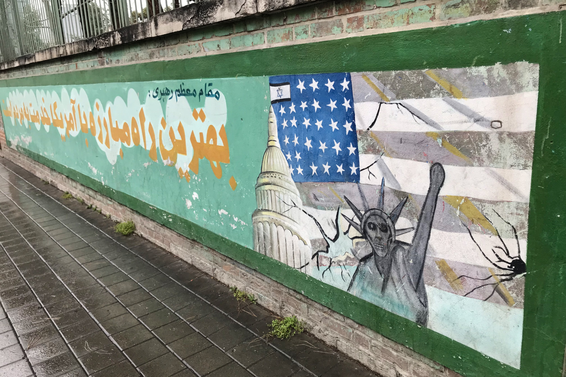
The best examples I can give you of this are Iran and Syria –places most people warned me against, and that ended up being some of the most heartwarming, welcoming experiences I’ve ever had.
Check the map you’re using. Before you even arrive somewhere, pay attention to your mental map. What do you think you already know about this place? Where did that knowledge come from? News headlines, films, guidebooks, other travelers? You don’t need to discard it. But you must remember that it’s a story, not a fact. When you get there, pay attention to what’s not being shown to you. The neighborhoods not mentioned in guidebooks. The histories not included in walking tours. The people who aren’t represented in the version of the place you’re being sold. Absence is also information. Sometimes more revealing than what’s present.
Cairo’s monuments are extraordinary, but wandering into the Garbage City and the City of the Dead taught me more about Egypt than anything the tourist map was pointing me toward.
Ask better questions. Instead of just observing, ask questions that don’t assume the answer. Not just “why is this place like this?” but “how did this place become what it is?” The quality of your questions determines the quality of the map you build. Resist the urge to summarize a place when you leave. “It’s chaotic”, “it’s peaceful”, “it’s dangerous”, “it’s authentic”. These are just new maps you’re drawing for someone else: easy to share but just as misleading as the ones you arrived with.
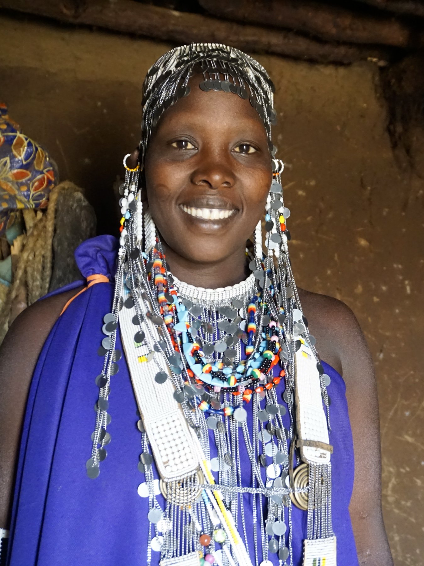
I learned this most vividly in Tanzania, in a moment that later reshaped how I think about feminism and travel, when a question I asked a Maasai matriarch didn’t land the way I expected –and forced me to confront how much of my curiosity was built on assumptions without a cross-cultural context.
Stay longer than your assumptions –long enough for your first impression to become uncomfortable. The first version of a place you see is usually the one that confirms what you expected. The second version –the one that contradicts it– takes time. Then interrogate your own role. Ask yourself not just what a place is, but what your presence does to it. Whether you’re reinforcing the version of the place that’s easiest to sell, or engaging with the one that exists beyond you.
I’ve seen this most clearly in the world of volunteering abroad, especially around voluntourism in Africa –where something that feels unquestionably good on the surface can, with a bit more time and context, reveal a much more complicated, and even darker reality.
Look for the places where a culture is still speaking in its own voice. Sometimes that voice is recognized formally through UNESCO intangible cultural heritage. More often, it’s less obvious. They are not boxes to tick but living expressions of what a community has decided is worth preserving. Places where you’re most likely to encounter tradition that hasn’t been packaged for export: local music, food preparation, craft techniques, festivals, oral traditions. Eat the food that isn’t on the tourist menu. Buy from artisans. Move through the place the way people who live there do. Go to the market that serves the neighborhood, not the one created for visitors. These are the places where the map starts to break down –and something more complex begins to take its place.
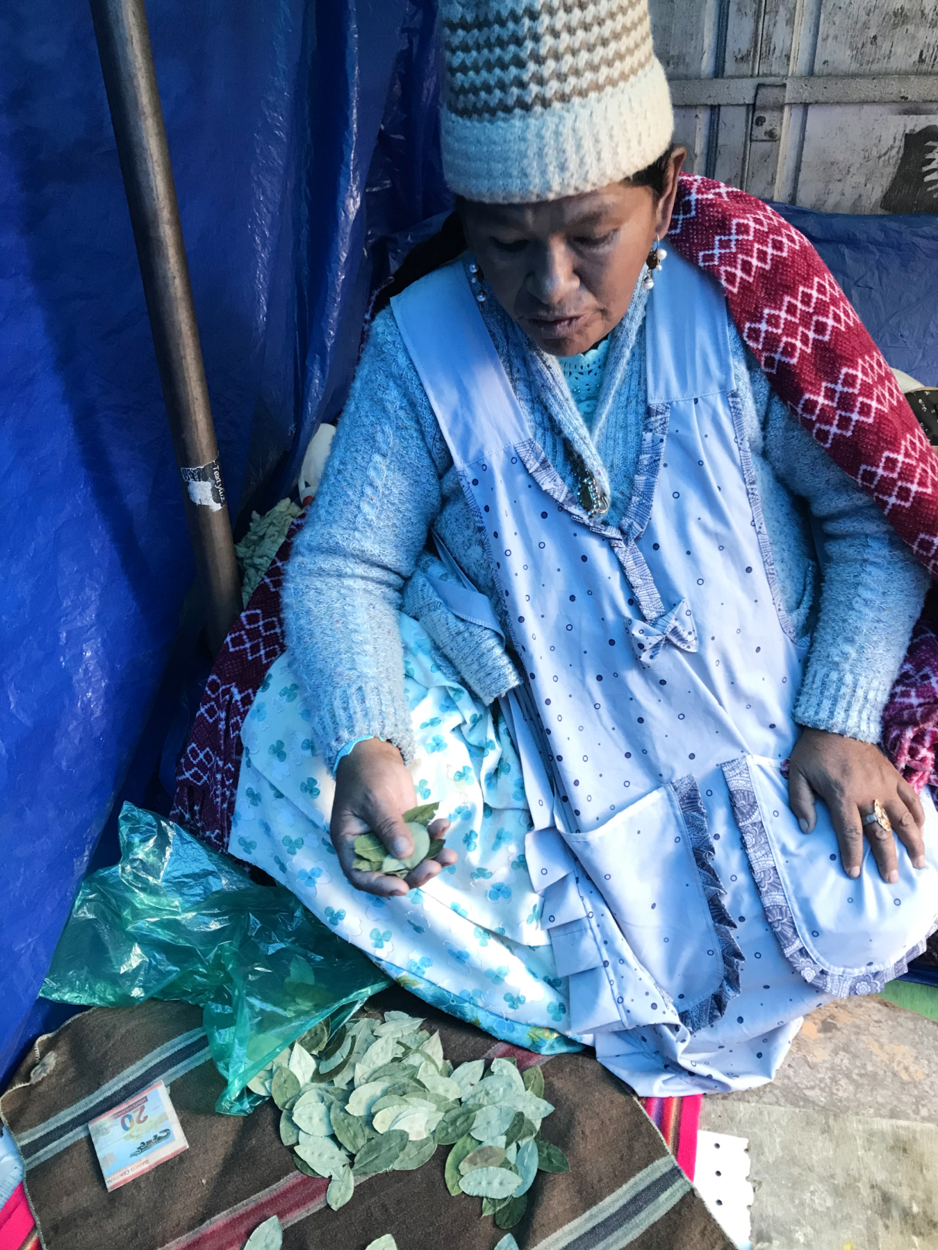
I’ve felt this most clearly standing among the lingering Lenin statues of Transnistria, witnessing Andean customs in Bolivia, navigating the tension between Indigenous traditions and conservation efforts in Tanzania and sharing mint tea in Jemaa el-Fnaa in Marrakesh –moments where the place’s culture speaks for itself, without translation.
The hardest part of taking action is unlearning –it’s slower and less comfortable than learning because it requires you to sit with the possibility that the map you’ve been using is wrong. Wrong about which countries matter. Wrong about which cultures have something to teach. Wrong about what progress looks like, and who gets to define it, and whether the place you just left is better or worse because you were there.
Travel doesn’t automatically dismantle those assumptions. Plenty of people circle the globe and come home with every prior belief confirmed. But it creates the conditions –if you let it, if you resist the pull toward the familiar and the confirmatory– for the map to be revised. And a revised map, held more lightly than the last one, is perhaps the most useful thing you can bring home. Not a souvenir. A correction.
Further Reading on Maps, Power, Colonialism and Perception
If this essay made you want to dig deeper into the fascinating world of maps, these are the books that shaped it:
On maps:
- On the Map by Simon Garfield. Easily readable and full of the kind of detail that reframes how you look at every map you’ve ever seen.
- A History of the World in 12 Maps by Jerry Brotton. From Ancient Greece to Google Earth, this book explores how each one of 12 maps changed the perception of the world when it was created.
- How to Lie with Maps by Mark Monmonier. Does exactly what the title promises, methodically and with dark humor.
- Prisoners of Geography by Tim Marshall. How physical geography has determined political history, for anyone who wants the geopolitics made visceral.
On language and power:
- Orientalism by Edward Said. The foundational text on how Western language constructed the East as its opposite. Dense but essential.
- Nineteen Eighty-Four by George Orwell. Fiction, but the Newspeak appendix alone is worth the essay’s argument about language and thought control.
- Through the Language Glass by Guy Deutscher. A more accessible exploration of how language shapes perception –does the language you speak change what you can think?
On colonialism and naming:
- Decolonizing Language and Other Revolutionary Ideas by Ngũgĩ wa Thiong’o. A Kenyan writer on the colonial erasure of African languages and culture, written with controlled fury.
- Cobalt Red by Siddharth Kara. Contemporary colonial extraction –the minerals in your phone, where they come from, who pays.
On travel and bias:
- The Art of Travel by Alain de Botton. Philosophical, occasionally self-indulgent, but genuinely useful on why we travel and what we expect to find.
- Neither Here Nor There by Bill Bryson. A lighter counterpoint –what happens when a careful observer still can’t escape his own assumptions.
Other Essays on Geopolitics and Travel from Experiencing the Globe:
- Geopolitics of Travel: Insights Beyond What the Media Portrays
- Does Your Place of Birth Determine Who You Are? A Reflection on Tourism, Migration and Globalization
- What Feminist Travel Actually Looks Like –And Why Most of Us Are Doing It Wrong
Liked it? Want to read it later? Pin it!
Enjoyed what you read? A lovely way to show appreciation is by buying me a coffee.
Your support keeps the stories, guides and geopolitical insights coming. Thank you so much!


This is one of the best travel articles I have come across in recent times. Changed my perspective in so many things.
I love this. I am currently in Greenland and I was explaining on my fb page about how distorted Greenland is on the map we were raised with. Most people have no idea. Thanks for this great info.